Timing is Everything
Navigating the shifting peaks and valleys of our water supply
Everything around here comes back to water. From the deep powder in the mountains that draws visitors and locals, to the torrential summer rains that revive dusty sagebrush and alfalfa, it dictates our lives.
Warm spring sunshine and melting snow tell the first buds of grass to sprout from newly uncovered earth; the first snowflakes signal impending hibernation for grizzly bears and migrations for many animals that don’t sleep away the cold months. We live by cycles of water, farmers to anglers, skiers to builders. We find ourselves at its mercy, but we’ve learned to adapt.
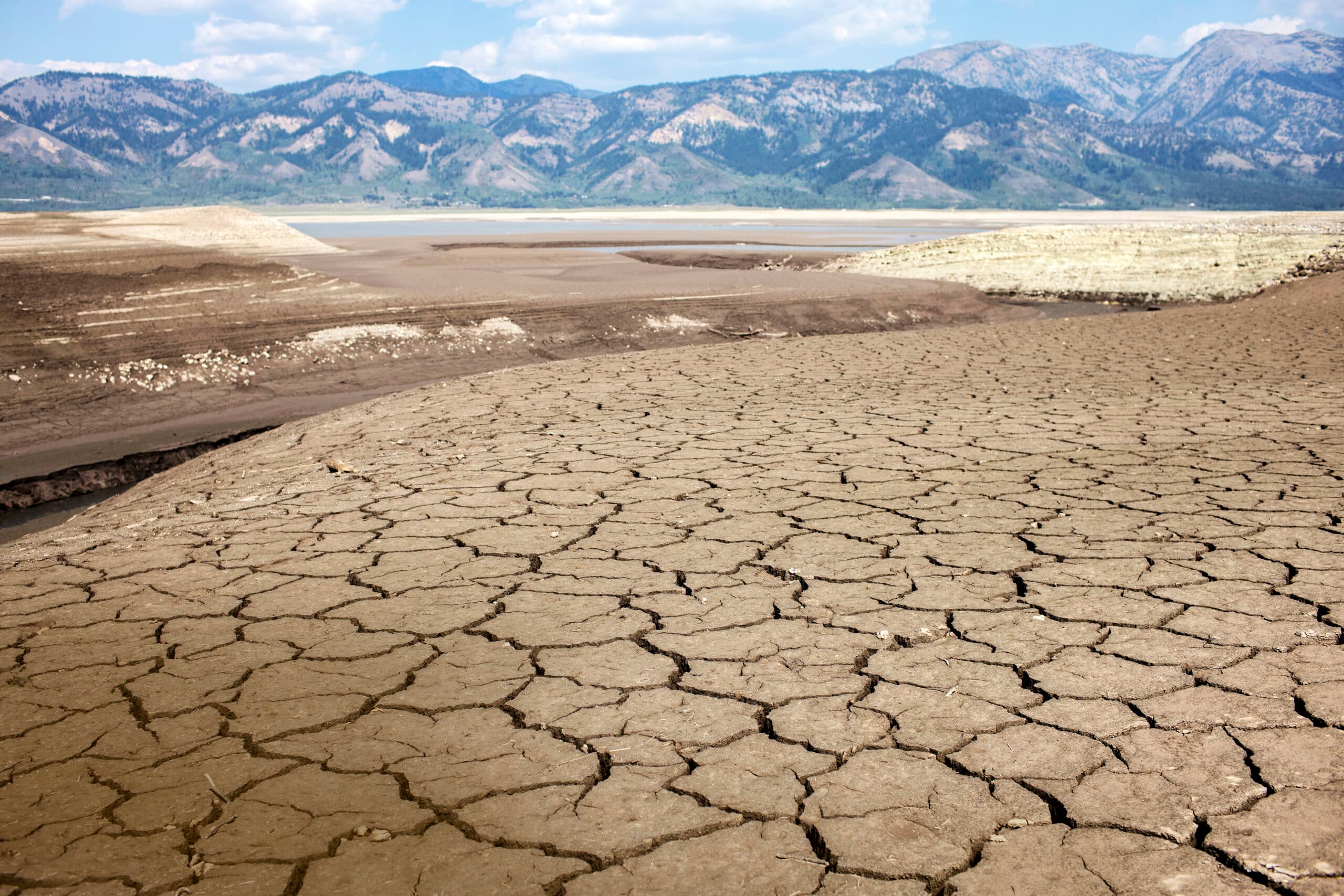
Now, it seems, we must adapt again. Drought, the bane of agriculture since humans first tilled rows in the Fertile Crescent of the Middle East, has descended over the Western United States, upending seasonal water cycles and, in the process, impacting ecosystems, farming, and recreation. And even with this past winter’s impressive snow totals, Teton Valley has not been immune.
“We’re living on a changed planet,” says Dr. Jen Pierce, a Boise State University professor and co-author of a 2021 climate assessment on the Greater Yellowstone Area (GYA). “We are not going back to the conditions that characterized, say, the 1950s through 2000s.”
It’s tempting to think “Dust Bowl” when you hear the word drought, but the reality is far more nuanced.
The University of Nebraska’s National Drought Mitigation Center defines drought as “a deficiency of precipitation over an extended period of time (usually a season or more), resulting in a water shortage.” For Teton Valley, drought impacts are most apparently revealed through changing precipitation patterns, rather than scarcity itself. According to the GYA climate assessment, the region’s overall precipitation has remained consistent in recent years, but drought impacts have been apparent.
“In Idaho, we’re fairly blessed with a lot of water,” University of Idaho hydrology professor Dr. Erin Brooks says. “It’s just a typical Western United States story that the timing is the problem.”
Seasonal cycles of water begin with the deep snowpack that accumulates in the mountains.
While this past winter felt bigger than normal to many, Will Stubblefield, the education and outreach director at Friends of the Teton River (FTR), says that compared to the dryer than average winters of the past few years, we may all be feeling a bit more impressed with something that’s actually fairly normal. This winter, he says, was just about 10 to 15 percent above normal snowpack totals in many areas.
“This big winter is a great step in the right direction in regard to improving our water supply,” Will says. “But it will likely take multiple years of above average precipitation and snowpack to get our overall water supply back to a healthy place after multiple years of drought.”
The water supply includes everything from groundwater and surface water to constructed storage reservoirs.
“Our water supply is at its best when all of these different components are full of water, but it’s not as easy as it sounds to transfer the mountain snowpack into each of these different containers all at once,” Will says.
As spring temperatures rise, that snow melts, percolating into the tributaries and headwaters that cleave the mountain valleys, filling rivers, and replenishing the series of reservoirs across eastern Idaho and western Wyoming. Rain adds to the water levels, but the main contributor is snowmelt.
Historically, farmers have funneled water through irrigation ditches to start crops, then depended on a mixture of irrigation and summer rain to make it through July and August, our hottest months. But the schedules they’ve depended on are shifting, and rain in those driest months has become scarcer, meaning farmers must adapt to the changing world.
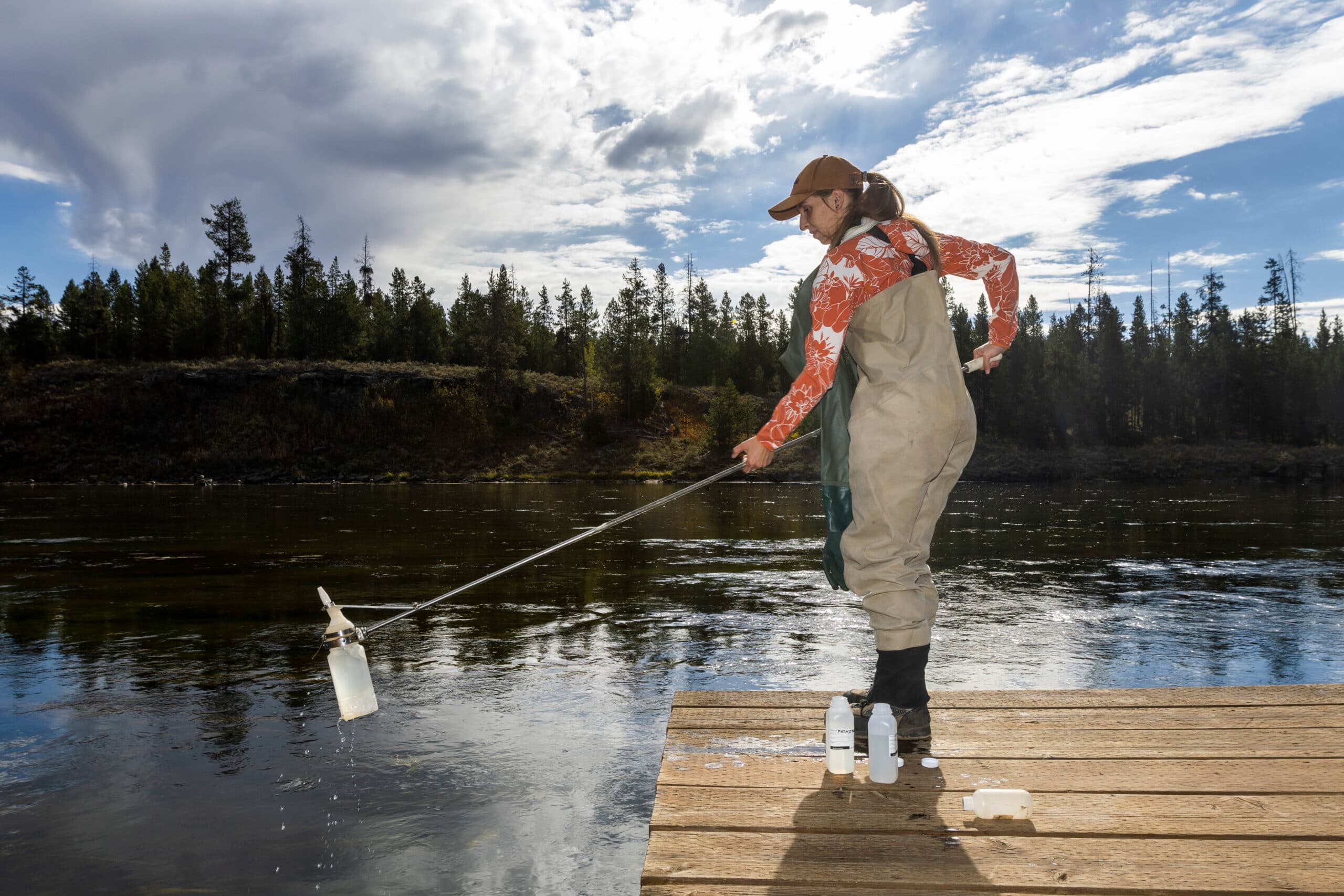
Employees from Henry’s Fork Foundation test the depth of the Henry’s Fork River near the Island Park Dam October 2022.
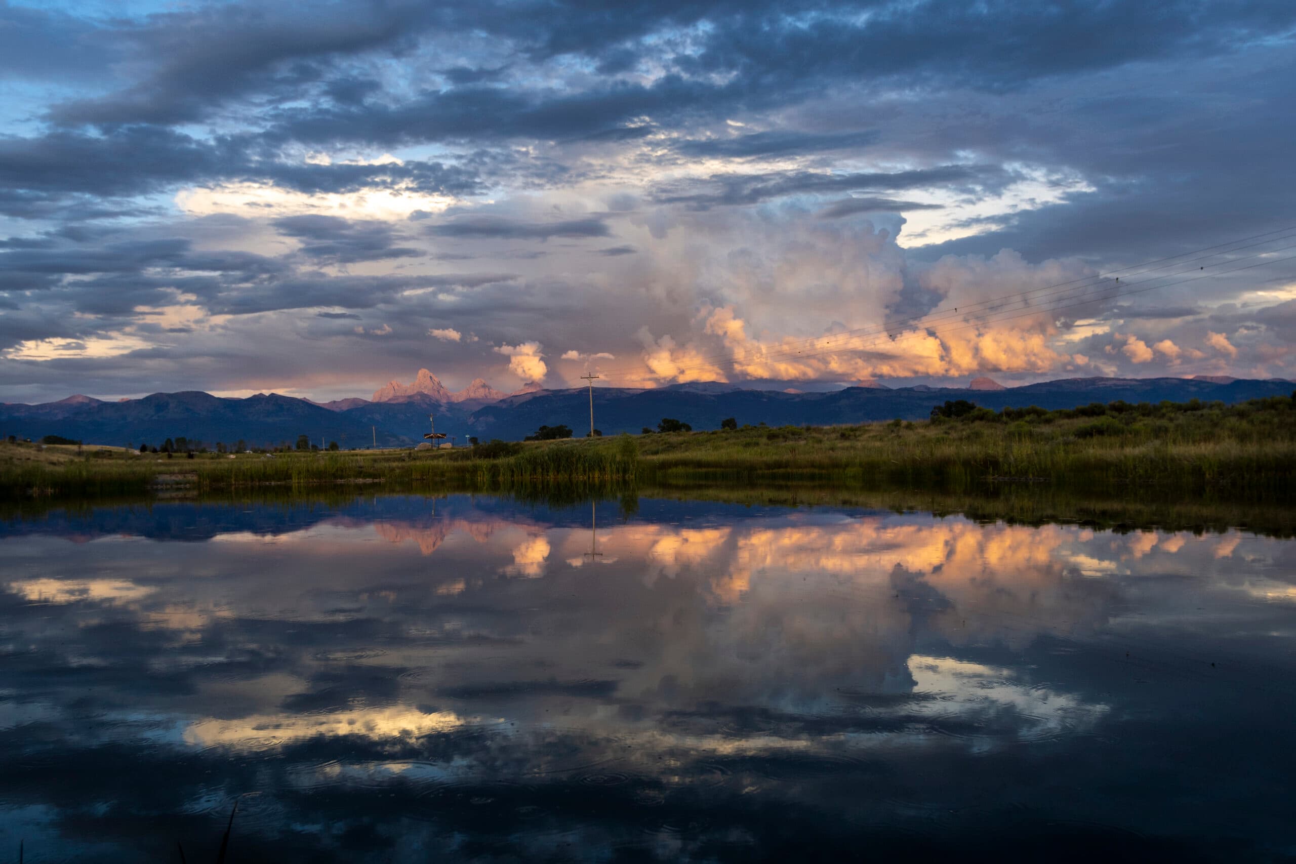
View of the Tetons from the Teton River
The first change relates to the timing of when meltwater creeps down the mountainsides, measured in peak streamflow—the date when the amount coursing through our waterways is highest. Peak flows represent the turn toward the dry season in June, July, and August. The GYA climate assessment notes those have shifted about eight days earlier on average in response to rising spring temperatures, similar to the shift during the Dust Bowl drought in the 1930s. Interestingly, the Teton River is the only river in the GYA in which peak flows have shifted to later. Though year-to-year variability means peak flows can still happen later than average, it indicates the dry summer season is increasing. The climate assessment report estimates that by the year 2100 the growing season in the Upper Snake River watershed will increase by thirty-two days.
Changes in the timing of precipitation also impact Teton Valley ecosystems and farmers. Summer rains decreased up to 17 percent in the GYA between 1950 and 2018, diminishing the amount of water for crops and aquatic habitats. Late spring and fall precipitation have increased by 20 percent and 24 percent, respectively, so even though annual precipitation has remained constant, less of it falls when farmers need it most.
Those changes can result in lots of water when farmers don’t need it, and shortages when they do. Water rights, or the amount that each landowner or entity is allowed to draw from the entire system of rivers, canals, and reservoirs, is based on a complicated hierarchy of priority. At the most basic level, older, senior rights trump newer, junior ones. So, when the system lacks enough surface water in rivers to fill everyone’s allocations, junior rights holders must turn their diversions off. Producers can also purchase storage allocations from regional reservoirs, which they can use to supplement their allotment. But should reservoirs not fill, those storage allocations may not be available.
“The problem with low snowpack years is we don’t get a full allocation out of the storage reservoirs,” says Tony Olenichak, water master for District 1, which covers the bulk of eastern Idaho.
Before roughly April 15, producers can’t start drawing through their diversions, so any increase in streamflow before then is helpful only in that it helps fill reservoirs. In Teton Valley, where mountain snows stick around longer than in many parts of Idaho, more spring runoff doesn’t equate to more water for crops. Same goes for late-season rain: By the time October rolls around, which since 1950 has seen a 42 percent increase in precipitation, most farmers don’t need the rain. It might even cause problems for harvesting crops or drying hay.
“It isn’t always just the volume of water,” says Carl Allen, president of Trail Creek Sprinkler, an irrigation co-op in the Victor area. “Sometimes it’s the timing of when you get the rain or when you don’t get the rain.”
Trail Creek’s members are junior to water rights lower in the Snake River watershed, so their water is shut off sometime during the summer. Olenichak’s office decides that date, which changes every year. After that, Allen says, they have storage allocations in Grassy Lake Reservoir, so in exchange for continuing to use water in the upper part of Teton Valley, they release part of the reservoir to fulfill those downstream users’ claims. Across the GYA, valley-level snowpacks have decreased, so it’s possible that Grassy Lake won’t fill enough for Trail Creek to use its allocation.
Sometimes, water in Trail Creek’s area is so low it won’t reach the downstream users, a situation called a “futile call,” and its users can continue to use any remaining water. Should Trail Creek Sprinkler run out of surface water and its Grassy Lake allocation, its members must scramble. “The only time we’ve had any curtailment is when there just isn’t enough flow in the stream,” Allen says. “That has happened a few times, then we have to go on terms.”
In that situation, water users alternate days they use irrigation water, setting up difficult decisions about what to do with crops. “With grains, you just have to cut it for hay if you don’t have enough water to get through,” he says. “Potatoes are a harder problem because they require water clear until you’re getting ready to harvest.”
Employees from Henry’s Fork Foundation test the depth of the Henry’s Fork River near the Island Park Dam October 2022.
Media Credit
30259225A
A dry lakebed is seen at the Palisades Reservoir, on the Snake river in Bonneville County, Idaho August 25, 2021. According to the Bureau of Reclamation, the reservoir is 24% full following a summer of drought.
Media Credit
Should Teton Valley find itself in that scenario, where irrigators don’t have enough water, aquatic wildlife would also find themselves hard up. “Flows for fish aren’t [defined as] beneficial uses, so they don’t have any sort of legal framework within the water rights system,” says Dr. Rob Van Kirk, science and technology director at the Henry’s Fork Foundation in Ashton. Less water in the Teton River, especially during the summer’s warmest months, can have deleterious consequences for fish, which rely on cold water for spawning. Shallower water is warmer, and with rising air temperatures (between 2- and 5-degrees Fahrenheit since 1950 across the GYA), atmospheric conditions will continue to heat the river, which could degrade fisheries and deteriorate the quality of local fisheries. By extension, it would also negatively impact the part of the summer tourism economy that depends on anglers.
“For the long haul,” Will Stubblefield says, “if we think in the West it’s going to get warmer, that means rivers are going to get warmer.”
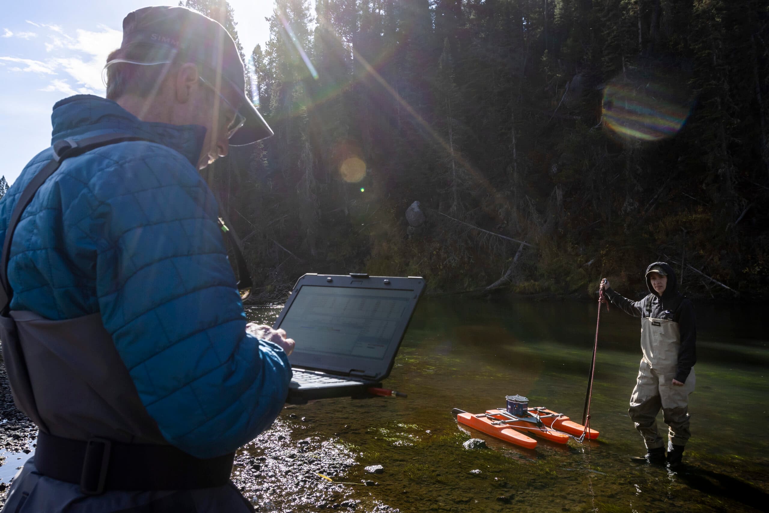
Just upstream of where Highway 20 crosses the Buffalo River in Island Park, Van Kirk and Amber Roseberry slogged through riparian plants to reach the bank. Van Kirk knelt, water seeping up through the soil as his knees compressed the earth. The October sun was shining, with a touch of crisp fall cold in the air. As he watched the screen of his laptop, Amber piloted an Acoustic Doppler Current Profiler across the 50 yards of water at a snail’s pace. Three minutes across, and she spun the craft around. Three minutes back.
Using SONAR, the machine gathered information on depth and flow, then beamed it to Van Kirk’s computer, telling him how much water was in the river. Henry’s Fork employees take such measurements in the watershed year-round, hoping to gain a thorough understanding of how much water is available over time. On the Buffalo River, Van Kirk says, he gains particularly useful information because no diversions or dams impede its flow. Their work is a small part of what he says is needed to adapt to the impacts of drought: precision water management, a tactic that uses available flows for irrigation when needed and conservation aims when possible.
Precision water management works within the established system of water rights. Essentially, if a canal company has the right to use water but its members don’t need it, the company can still divert it, allowing it to seep into the ground and replenish the aquifer. Managed aquifer recharge can bring the water table closer to the surface and keep more water in streams later in the summer, helping both fish and farmers.
“It helps keep the wells in this end of the valley and the springs down by the river flowing better in late summer,” says Carl Allen of Trail Creek Sprinkler, which has worked with FTR on its managed recharge program.
That FTR program pays agricultural producers to open their diversions as soon as they can, even if they’re not ready to plant. FTR’s original goal was to replenish 10,000 acre-feet of water into the valley’s aquifer.
“We hit 10,000 acre-feet for a couple years running,” Stubblefield says. The long-term goal is to prove the efficacy of recharge and find a market-based incentive that would replace the grant funding FTR currently uses.
Recharge is just one strategy water managers and farmers are implementing to stave off the worst effects of the changing climate. New agricultural research shows regenerative farming techniques, including cover crops, no-till methods, adaptive grazing, and crop rotations, can improve yields, reduce costs, and serve conservation goals. For example, cover crops—ones planted to improve soil, rather than for harvesting—increase soil health by cultivating healthy bacteria and invertebrate populations. They also reduce fertilizer use, saving farmers money and reducing nitrates, which can produce powerful greenhouse gases, and cut water usage by building better storage capacity in the soil.
“It’s what I call a win, win, win,” says Dr. Erin Brooks, University of Idaho hydrology professor.
According to Brooks, large, multimillion dollar grant programs are underway through his university to encourage regenerative practices across the Snake River Plain. Smaller-scale programs are happening in Teton Valley, as well. FTR, the Henry’s Fork Foundation, the Teton Soil Conservation District, and other local entities have formed the Teton Valley Water Users Association, which is dedicated to developing solutions that help farmers and promote conservation.
“The goal of that is to really get incentives for ag producers to implement best management practices that benefit the health of the watershed,” Stubblefield says.
None of these practices on their own will be enough to combat the changes brought on by increased temperatures and altered precipitation schedules. But farmers, nonprofits, and water managers alike hope to build resilience in agricultural and ecological systems. After all, the weather in Teton Valley has always been unpredictable, even before the changes in the past half-century, something farmers know all too well.
“There’s very little that you can control about what happens out in that field other than what you put in,” Allen says.
With these strategies aimed at improving outcomes for farmers, fish, and others, everyone’s just trying to control what they can.